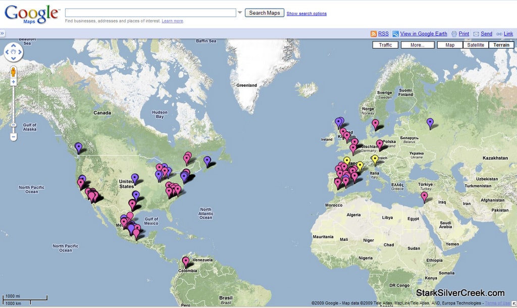
For those of you interested in following the progress of Swine flu incidents, Google Maps provides a great way to view the different reports by geography. You can check out the updated map here.
When you land on the page, be sure to zoom out in order to see the view that you see in the above screen shot I took. You can click on any of the markers and see the related story.
From the map so far, it looks like all Swine flu outbreaks along the Baja peninsula is in Baja California Norte, not in Baja California Sur where Loreto is located. There are two “suspected” incidents reported so far in Santa Clara County, California.